


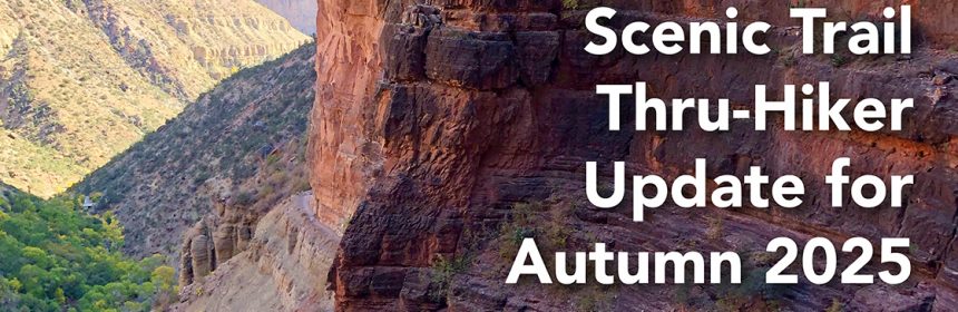
Arizona National Scenic Trail Thru-Hiker Update for Autumn 2025
Arizona National Scenic Trail Thru-Hiker Update for Autumn 2025
After a dry winter and a parched spring, we all knew this could be the worst wildfire year in recent history. But we held out hope for a bountiful summer monsoon season. Instead, we keep seeing heat records being broken and rainstorms yielding just a few intermittent drops. Living in the Southwest during a prolonged drought is challenging, and despite our efforts to maintain and improve the trail; enhance water sources; and make the Arizona Trail the premier long-distance trail in America, attempting to walk or ride 800 miles gets more intense every year.
The White Sage and Dragon Bravo fires have impacted almost 100 miles of the Arizona Trail this season. Through recent reports from agency staff assessing the damage on the ground and from the air show us that approximately 35 miles were directly impacted. Some good news is that only 2% was a high intensity burn; 26% was moderate; and 65% was low intensity. The Arizona Trail Association is working with the US Forest Service to reroute the AZT around the most severely burned areas on the Kaibab National Forest, utilizing trails and dirt roads to provide a safe and scenic alternative to segments of trail that are closed for now.
However, the AZT within Grand Canyon National Park is likely to remain closed for a much longer period of time. How long? Nobody really knows. It all depends on how much damage occurs during the summer monsoons and then winter storms, and how quickly the trail can be rebuilt. If this were anywhere else in the state, we could come up with a creative reroute. But rerouting around THE GRAND CANYON is nearly impossible. So for the first time ever, there is no connected route from Mexico to Utah. This is tough news for all of us at the ATA who work hard year-round to ensure there’s a continuous path. We know it’s going to disappoint a lot of would-be thru-hikers and bikers, but if there’s anything we have learned from the Arizona Trail it’s that moving with the rhythms of nature is key for survival.
This update is intended as a planning guide for anyone considering a thru-hike or ride on the AZT this autumn season. Information will be updated on our website and social media platforms as conditions change and we have new information to share.
Hwy 89A is open. This gets you access to the Orderville Trailhead and the town of Jacob Lake.
Hwy 67 is open from Jacob Lake to the Kaibab National Forest/Grand Canyon National Park boundary.
Affected passages from north to south:
Passage 43 (Buckskin Mountain) / Stateline Campground to Winter Road – Open!
Passage 42 (Kaibab Plateau North) / Winter Road to Orderville Trailhead – Open!
You will see impacts from the Mangum Fire (2020) and White Sage fire (2025). Please be cautious when traveling through burned zones, especially standing dead trees that can fall at any time.
Passage 41 (Kaibab Plateau Central) Orderville Trailhead to Telephone Hill Trailhead – Open!
Passage 40 (Kaibab Plateau South) Telephone Hill Trailhead to Forest/Park Boundary – Open!
Passage 39 (Grand Canyon North Rim) Forest/Park Boundary to North Kaibab Trailhead – CLOSED
This will likely remain closed for the next year.
Passage 38 (Grand Canyon Inner Gorge) North Kaibab Trailhead to South Kaibab Trailhead – CLOSED, except for 4 miles from South Kaibab Trailhead to The Tipoff
A portion of this passage may open later this year, connecting the South Kaibab Trailhead to Bright Angel Campground and Phantom Ranch. But the 14 miles from the Ranch to the North Kaibab Trailhead will likely remain closed for a year or longer depending on the extent of the post-fire erosion, flooding, and damage to the trail, bridges, water line, and other infrastructure.
Please refer to the Current Closures, Restrictions & Reroutes.
We also update Alerts and information on the FarOut app as soon as we get the information, so you can check that while you’re out on the trail. Just look for the red triangle alert symbol.
So what’s a thru-hiker to do?
If you’re trying to be entirely self-reliant, start at the South Kaibab Trailhead and hike 4 miles north to The Tipoff. Enjoy being inside one of the seven natural wonders of the world and look down on the mighty Colorado River that formed this gorgeous landscape. Then hike back uphill and begin your southbound journey to the US/Mexico border. This means you’ll miss the northern 100 miles of trail. Maybe that means you’ll return in the future to finish that section.
If you have vehicle support, start at Stateline Campground and hike to the Kaibab Plateau Trailhead and then catch a ride all the way around to the South Kaibab Trailhead.
Currently, there are no shuttles transporting visitors between the North and South Rims of Grand Canyon, so the scenarios mentioned above would only be possible with support from friends. If TransCanyon Shuttle or others resume operations this season, we’ll let you know as that may provide options for driving around the closed passages.
Mountain bikers who don’t mind some highway miles and dirt tracks on the Navajo Nation should consider researching Segment 7 of the Western Wildlands Route developed by our friends at Bikepacking Roots.
Every day that goes by that the AZT is not a continuous path, we’re not fulfilling our vision. We appreciate your patience and support as we work through these unprecedented challenges. All of us are working hard to reopen the AZT and/or identify reroutes with your safety as our top priority. Please avoid closed areas, understand the hazards of traveling through burned forests that have reopened, and enjoy every mile you’re able to hike or ride this year.
Our commitment to the ATA’s mission and vision is unwavering. We hope your support remains just as strong. Every dollar you donate will support rehabilitation of the AZT, construction of new trail around severely damaged areas, improvement of water sources, and so much more. Please consider donating today.
