


Find maps of various kinds to help guide you along the Arizona Trail, from paper topo maps to the FarOut mobile app.
FarOut App
Quite possibly the most comprehensive navigational resource when you’re on the trail, the FarOut (formerly Atlas Guides Guthook) App works without cell phone connectivity and provides up-to-date information on water sources, gateway community amenities, closures and detours, comments from recent trail users…and shows you right where you are on the map at all times. Download it for $24.99 in your App Store and hit the trail!
Interactive Map
The Arizona Trail Interactive map was created by Aaron Seifert, GIS Director for the ATA. You can view various layers to get the most out of planning for your next adventure — from active wildfires, important birding areas, planned re-routes, and much more!
Arizona Trail on Google Earth
You can download a file containing all of the current Arizona Trail GPS data in a format that is displayable on Google Earth. If you are not familiar with Google Earth, you can go to the Google Earth download page to learn about it and download the FREE software. Once you have this software installed, or if you already have it, click on the link below to download the Google Earth/Arizona Trail data file. Save this file on your computer and then open it using Google Earth.
Download the Arizona Trail Google Earth KMZ File
This can be viewed in Google map Apps and imported into any map within the Avenza Maps App.
Map of the Trail, a Story Map
Take a sky-high view of the entire 800-mile Arizona Trail as it runs from the Mexico to Utah borders. But you can also dive into all aspects of the trail with a tabbed interactive map to learn about the trail, its passages, mountain bike routes, Gateway Communities, water sources, photos from all over the trail, Arizona Trail Association Topo Maps, and the Arizona Trail App and much more linking back to this website.
Loop Trails
A listing of loop hikes/rides that can be done on the Arizona Trail. They are listed from south to north and vary in distance. Some of the loops are suitable for hikers, equestrians, and mountain bikers.
These routes and maps are only available to ATA members in their Members-Only Resources upon login. Not a member? Join or renew today.
Topo Maps
A complete topographic map set for those who prefer detailed paper maps. 126 total maps available as a printed set for $45 or as a digital download so you can print your own as you need them. We now offer this product to purchase and use within the Avenza Map app on your mobile device where you can see your location on each map and use many other features. ATA members have access to digital versions of the maps for free. Join or renew today.
Game Management Units Map
Hunting is allowed throughout Arizona, including on and near the Arizona Trail. However, it is unlawful to shoot across a road or trail or within 1/4-mile of a residence or occupied structure. It’s also unlawful to intentionally interfere with hunters. Please use this map when planning your adventures, and cross reference the game management unit #s with the hunting seasons for those units on the Arizona Game & Fish Department website.
GPS Card
The Arizona Trail Association’s GIS Director Aaron Seifert, with Garmin International, has created a preprogrammed data card for your handheld Garmin GPS device that features the entire Arizona National Scenic Trail. –OUTDATED–
AZT Map with Passages
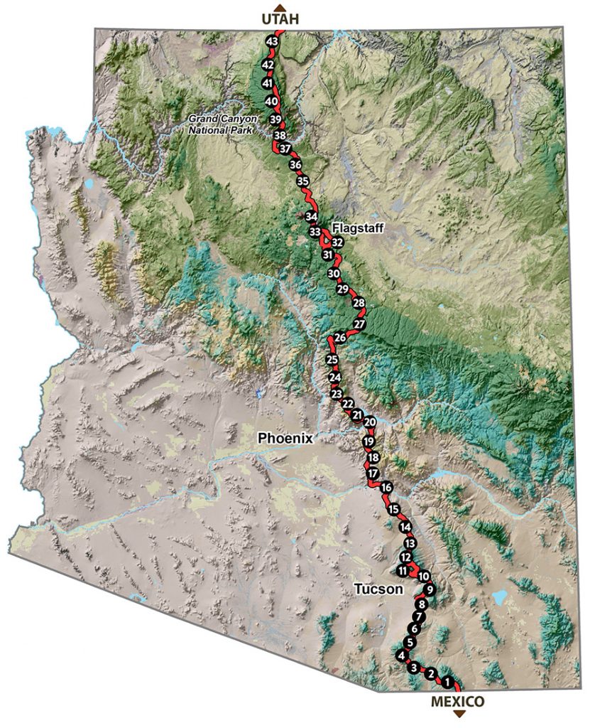
Visit the information for each of the passages here

