


The AZT along the AZ/Mexico border continues to be impacted by people crossing illegally into the United States. Many new side trails are being created by dispersed foot traffic and AZT users should avoid mistakenly taking these trails intersecting the Arizona Trail (sometimes the AZT is less distinct than these foot paths). Trail users may meet immigrants along this passage, especially near water sources, and although no negative incidents have ever been reported by AZT users, caution should be exercised when hiking and camping in the Huachuca Mountains. It is recommended to camp as far away from the trail as possible.
Read More
Location
- Parker Canyon Lake Trailhead to Canelo Pass
Length
- 13.8 miles
Southern Trailhead: Parker Canyon Lake Trailhead
- GPS Coordinates: 31.41959° N, 110.44178° W
Access
From the town of Sonoita, follow AZ 83 south 30 miles to its intersection with FR 48. Turn left (south) onto FR 48, continue 0.5 miles, and turn right onto South Lake Drive. Proceed 0.5 miles to a parking area near an AZT kiosk.
Northern Trailhead: Canelo Pass
- GPS Coordinates: 31.51287° N, 110.55827° W
Access
From the town of Patagonia, follow Harshaw Road (FR 58) east 14 miles to an intersection where FR 58 makes a 90-degree turn to the right. Avoid this turn and continue straight ahead (east) on FR 799. In 5 miles, cross Canelo Pass and continue about 0.5 miles down the other side to a large parking area on the left (west) side of the road. The trail toward Patagonia departs from the right side of a kiosk; the trail arriving from Passage 2 is on the left side of the kiosk.
From the town of Sonoita, follow AZ 83 south for 18 miles to a turnoff on the right for FR 799. Continue 2.9 miles to a parking area on the right that is marked with Arizona Trail signs.
Trail Route Description
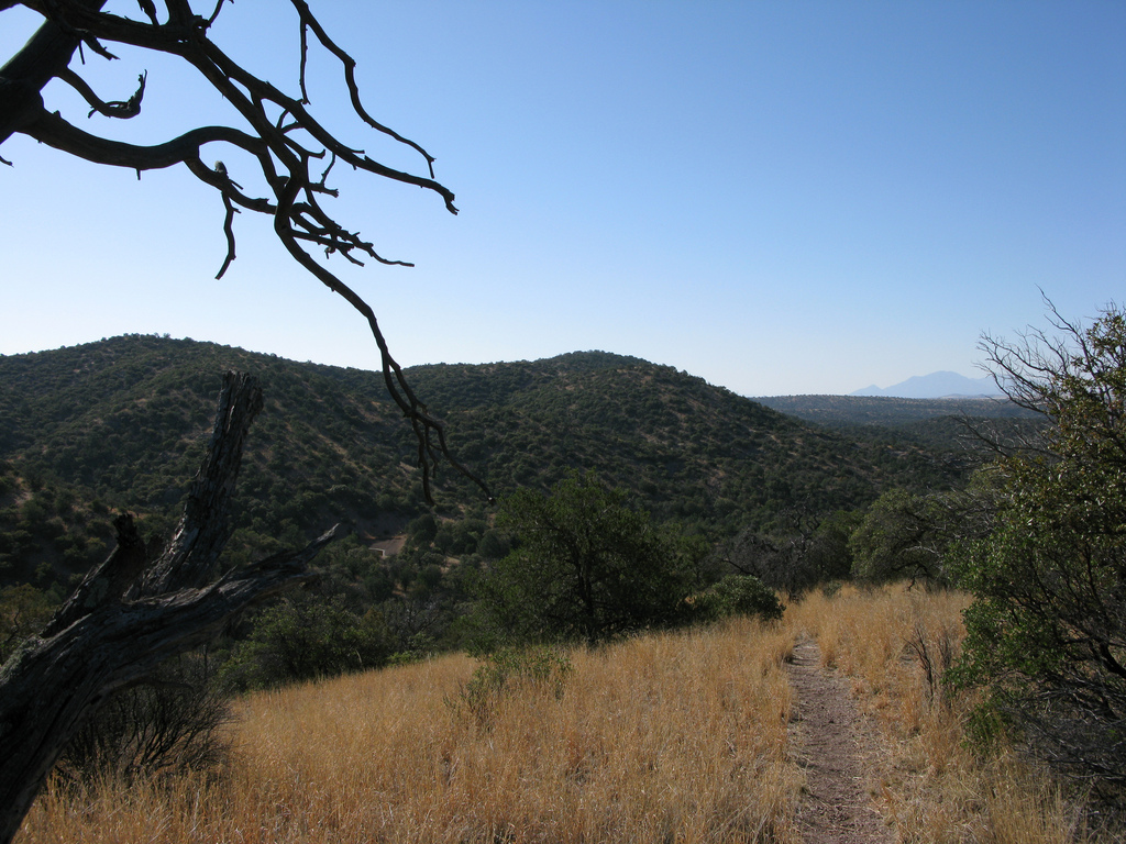
Passage 2 traverses the east side of the Canelo Hills, a seldom-traveled range of low mountains that connects the Huachuca, Patagonia, and Santa Rita Mountains. Sitting in the shadow of these larger mountain ranges, the Canelo Hills are often overlooked by outdoor enthusiasts and therefore visited by fewer people. But, as with many of Arizona’s natural wonders, careful examination reveals incredible beauty.
The trail through this section follows a singletrack path that descends through grasslands and evergreen oak woodlands. It rises and falls over rocky terrain, and crosses several arroyos where cairns help guide the way. It features interesting geology, shallow canyons, oak savannas, and mesquite bosques, as well as panoramic views of the San Rafael Valley to the southwest and the Huachuca Mountains to the southeast.
Campsites with beautiful views are abundant here, but water may be scarce and it is best to stock up at the beginning of the passage. Following a wet winter, however, some of the small canyons crossed by the trail may trickle with water, nurturing lush growth and spectacular springtime wildflowers!
Difficulty
- Moderate
Season(s)
- Fall, Winter and Spring
- Current weather forecast
Water
Parker Canyon Lake at the beginning of the passage has water. Parker Canyon, about 2.5 miles later, usually has water. Other drainages/tanks may have seasonal water. Check the online Arizona Trail Water Report for current information at https://aztrail.org/explore/water-sources/.
Notes/Warnings
- Water is intermittent and scarce. Plan to bring your own water. All water along this passage should be purified prior to use.
- Trail is designed for hiking and horseback riding. Mountain bikes are permitted.
- Cattle grazing occurs along the route of the trail. Please close all gates.
- Mines are located near some of the trail routes and are marked. Please stay on the trail.
- Developed campsites and a seasonally operated concession store are located at Parker Canyon Lake.
Resources
- MAP
- PROFILE
- TRACK
- Waypoints: GPS | MP
- Arizona Euro-American History
- USGS Topographic Maps: Huachuca Peak, Canelo Pass and O’Donnell Canyon
- Coronado National Forest, Sierra Vista Ranger District.
- BLM Information Center maps.
For more information
- The Passage Steward
- Coronado National Forest, Sierra Vista Ranger District, 5990 S. Highway 92, Hereford, AZ 85615 (520) 378-0311.
- BLM Information Center (602) 417-9300.
