


On Friday, December 16 the Arizona Trail Association celebrated the grand opening of the Oak Tree Canyon Trailhead on the Coronado National Forest near the town of Sonoita. After having been closed for nearly 20 years due to natural and cultural resource impacts from off-highway vehicles, we were delighted to have been granted permission to construct a trailhead at this scenic location. In addition to earthwork and steel fence construction, the trailhead also includes two steel gates and an interpretive kiosk that celebrates the Santa Rita Mountains as a cultural landscape that was developed in collaboration with the Tohono O'odham Nation. Oak Tree Canyon is located just west of Hwy 83 between mile posts 44 and 43, north of Gardner Canyon and the town of Sonoita. The trailhead provides ideal access to the oak woodlands of the Santa Rita Mountains -- just follow FR 4072 for one mile to the AZT. The trailhead is large enough to accommodate up to 40 passenger cars plus 8 trucks and horse trailers. The Grand Opening Celebration was attended by nearly 75 people, including Arizona Trail staff and trail stewards; Coronado National Forest employees; representatives from the Tohono O'odham Nation; youth and teachers from...
Read More
Location
- Apache Springs Trailhead to Oak Tree Canyon
Length
- 13.8 miles
Southern Access Point: Apache Springs Trailhead
- GPS Coordinates: 31.71873° N, 110.75704° W
Access
From Sonoita, follow AZ 83 north 4 miles and turn left (west) onto Gardner Canyon Road (FR 92). Avoid side roads. You’ll reach the Apache Springs Trailhead 5.5 miles from the highway on the right side of the road. There is a large parking area here.
Northern Access Point: Oak Tree Canyon Trailhead
- GPS Coordinates: 31.81072° N, 110.72330° W
- NOTE: The AZT is approximately 0.7 miles west of Oak Tree Canyon Trailhead (31.81010° N, -110.71101° W) along a two-track road.
Access
From the intersection of I-10 and AZ 83, drive south on AZ 83 for 15 miles to milepost 43.2. Oak Tree Canyon Trailhead is located just west of the highway and is large enough to accommodate 40 passenger cars and up to 8 trucks and horse trailers.
Trail Route Description
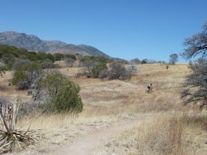
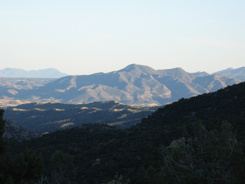
Passage 5 traverses the northeastern foothills of the Santa Rita Mountains. Located in southeastern Arizona, the Santa Rita Mountains are rich in biodiversity and home to black bears, bobcats, and even jaguars.
This section features expansive mountain views, craggy peaks, and a visit to a historical site. It consists of singletrack, doubletrack and dirt roads that rise and fall across an alternating terrain of grasslands and dense forests of juniper, oak and manzanita. The trail crosses canyons and traverses scenic ridgelines with views of Mount Wrightson’s granite peak in the distance.
This section passes through Kentucky Camp, which consists of a collection of buildings that were established as a base of operations for the Santa Rita Water and Mining Company in 1904. It has since become a historic site that is maintained by the Forest Service and volunteers. Facilities at the camp include potable water, electrical outlets, and a toilet. The AZT passes right through the camp, and it is a perfect place to take a break.
Beginning in October, 2025, a 10.6-mile trail construction project will remove all dirt roads from this passage and replace with fresh singletrack construction. The project is anticipated to be finished by Summer, 2026. For a map of the Santa Rita Foothills Singletrack Project, click here.
Difficulty
- Moderate
Season(s)
- Fall, Winter and Spring
- Current weather forecast
Water
Water is usually available at Kentucky Camp and Bowman Spring. Water may sometimes be found in stock ponds along the route. Check the online Arizona Trail Water Report for current information at https://aztrail.org/explore/water-sources/.
Notes/Warnings
All water along this passage should be purified prior to use.
Kentucky Camp is a collection of old buildings that were used for mining operations. A tour through this area is an interesting side trip on this passage.
Resources
- MAP
- PROFILE
- TRACK
- Waypoints: GPS | MP
- Arizona Euro-American History
- USGS Topographic Maps: Mount Wrightson, Sonoita, Helvetia and Empire Ranch.
- Coronado National Forest map.
- BLM Information Center maps.
For more information
- The Passage Steward
- Coronado National Forest; Zach MacDonald; (520)428-0062; Nogales Ranger District; 303 Old Tucson Rd., Nogales, AZ 85621
- Friends of Kentucky Camp
- BLM Information Center (602) 417-9300.
