


Vail Style Magazine (February 2021) by Kevin Boerup As darkness fell on the high, lonely desert at Cienega Creek one summer night in 1887, a Southern Pacific passenger train suddenly slammed on its brakes. Gunfire pierced the night and the Doc Smart Gang stepped out of the darkness. After robbing the train, a sheriff's posse was soon formed, and the gang's trail led to a cave in the foothills in the Rincon Mountains that they had been using as a hideout. The gang escaped to El Paso while the search for them continued. Today, the cave system where the gang had taken refuge is known as Colossal Cave, and the Arizona Trail passes right by it. It may not have been called the Arizona Trail back in the late 1880s, but that is only because the idea of a scenic, sustainable, non-motorized recreation trail from Mexico to Utah had not been dreamed of yet. To read the rest of the article, click here.
Read More
Location
- Gabe Zimmerman Trailhead to Saguaro National Park
Length
- 13.9 miles
Resources
- MAP
- PROFILE
- TRACK
- Waypoints: GPS | MP
- Arizona Euro-American History
- USGS Topographic Maps: Vail, Rincon Peak and Tanque Verde Peak
- Saguaro National Park map.
- BLM Information Center maps.
Southern Trailhead: Gabe Zimmerman Trailhead
- GPS Coordinates: 32.01362° N, 110.64730° W
Access
Take I-10 east and take Exit 279 (Wentworth Road/Colossal Cave Road). Turn east (left) for 0.2 mile to Frontage Road. Turn south (right) on Frontage Road for 5.2 miles to Gabe Zimmerman Trailhead.
Northern Access Point: Saguaro National Park
- GPS Coordinates: 32.12964° N, 110.64472° W
- NOTE: This trailhead is not directly accessible by vehicles. The nearest vehicle access is 2.8 miles west on the Hope Camp Trail at the Loma Alta Trailhead at 32.13294° N, 110.68700° W. There is limited parking with trailer parking 0.25 miles south.
Access
Hope Camp: No vehicle access – 3 miles required to reach the Hope Camp TH. On Old Spanish Trail, travel approximately 7 miles southeast of the Saguaro National Park Visitor Center, or go 4 miles northwest of Colossal Cave Mountain Park on Old Spanish Trail, then turn north on Camino Loma Alta Road. Go about 2.5 miles until it ends at a small trailhead/parking area. Travel 3 miles east on Hope Camp Trail to historic Hope Camp.
Trail Route Description
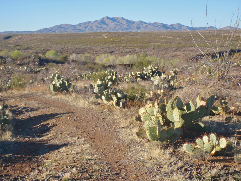
Passage 8 extends from Davidson Canyon to the southern boundary of Saguaro National Park. The trail is mostly singletrack with a few short ups and downs, leading to a longer, gradual descent. This biologically diverse section features thornscrub and semi-desert grassland environments, beautiful geology and the chance to see unique wildlife such as coatimundi and Cooper’s hawks.
This passage takes you through Cienega Creek Natural Preserve, a lush riparian corridor that has a perennial stream and harbors a population of native fish. It also supports cottonwood and mesquite trees as well as several species of birds, including some that are rare.
The trail follows Cienega Creek through Colossal Cave Mountain Park, home to one of southern Arizona’s most impressive cave formations. This desert park is listed on the National Register of Historic Places and features camping, snacks, and guided cave tours.
The trail continues north through the Rincon Valley, a vast landscape with desert scrub, tall saguaros, and inspiring mountain views. It crosses Rincon Creek, another riparian corridor, and concludes at the Saguaro National Park boundary.
Difficulty
- Easy to Moderate
Season(s)
- Fall, Winter and Spring
- Current weather forecast
Water
Water can usually be found at Colossal Cave Mountain Park in El Bosquecito Campground and the La Selvilla Picnic Area, and at La Posta Quemada Ranch. There is water in Cienega Creek and seasonal water Rincon Creek. Check the online Arizona Trail Water Report for current information at https://aztrail.org/explore/water-sources/.
Notes/Warnings:
- All water along this passage should be purified prior to use.
- A permit is required to enter Cienega Creek Natural Preserve. Please stay on the Arizona Trail route through this sensitive riparian area. If you remain on the trail, a permit is not required. Click here for more information.
- Colossal Cave Mountain Park has a fee and you must stay in the designated campgrounds of La Selvilla or El Bosquecito.
- A tour through Colossal Cave is an interesting side trip on this passage. There is a fee for the guided tours.
- Mountain bikes are prohibited in the Rincon Mountain Wilderness at the very northern end of this passage.
For more information
- The Passage Steward
- Colossal Cave Mountain Park, 16721 E. Old Spanish Trail, Vail, AZ 85641 (520) 647-7275.
- Saguaro National Park, 3693 S. Old Spanish Trail, Tucson, AZ 85730 (520) 733-5142.
- BLM Information Center (602) 417-9300.
